| Date | Walk | Distance |
|---|---|---|
| 04 December 2010 | A circular walk from Lewes, over Mount Caburn, to have a pint in the Snowdrop Inn | 8.8 km (5.5 miles) |
| 23 October 2010 | A walk from Bishopstone Station to Berwick Station by way of Alciston, to have a pint in the Rose Cottage | 14.7 km (9.2 miles) |
| 14 August 2010 | A circular walk from Balcombe, to have a pint in the Oak at Ardingly | 17.6 km (11.0 miles) |
| 03 July 2010 | A walk from Lewes to Uckfield by way of Barcombe, to have a pint in the Anchor Inn | 17.3 km (10.8 miles) |
| 24 April 2010 | A walk from Falmer to Lewes by way of East Chiltington, to have a pint in the Jolly Sportsman | 19.9 km (12.4 miles) |
| 20 February 2010 | A walk from Arundel to Amberley Station, to have a pint in the Bridge Inn | 15.5 km (9.7 miles) |
| 11 October 2009 | A circular walk from Lewes, to have a pint in the Trevor Arms, Glynde | 13.5 km (8.4 miles) |
Back in October 2009 I joined Ian, Graham and Keith for a walk from Lewes to Glynde and back, to have a pint in the Trevor Arms. Following the walk we decided to do another pub walk, and this has turned into a series of walks at roughly two monthly intervals.
The pattern of these walks is to meet at a railway station, walk about 6 miles to a nice country pub, have lunch, then walk about 4 miles to another pub near a bus stop or railway station convenient for the trip home.
I had categorised these walks as 'Miscellaneous walks' but there are now enough of then to justify their own page.
11 October 2009: A circular walk from Lewes, to have a pint in the Trevor Arms, Glynde
13.5 km (8.4 miles)

- Pells Lake, Lewes
In the course of a conversation with Ian about pubs, I mentioned the Trevor Arms at Glynde, a fine old-fashioned Harveys pub (not yet gastroed, and still divided into small individual rooms), and that it made an excellent destination for a short Sunday stroll over the Downs from Lewes. Ian thought it sounded a good idea, and so I agreed to meet him and a couple of his friends from Brighton (Graham and Keith) at 10:30 on Lewes Station.

- Footbridge over River Ouse
Whilst I was waiting for the Brighton train on Lewes Station, a couple of overseas students approached me and asked if I was leading a walk over downs, given I was obviously kitted out for walking. I agreed I was, but not theirs. We bumped into them again later, at Glynde.

- Trig point on Cliffe Hill
We followed the route I had devised as part of my series of walks to visit all the Marilyns and HuMPs south of London, taking in a visit to the top of Cliffe Hill. (One day I will get down the writing these walks up.) The walk takes an indirect route through the more picturesque parts of Lewes, passes the open air Pells swimming pool (the oldest still in operation, opened in 1860), crosses the Ouse and then passes through South Malling (the less picturesque bit of Lewes).

- View across Glynde to Firle Beacon
In South Malling the route crosses the A26 and follows Mill Road, a suburban street, to where it becomes a track. A little further on, a path doubles back southwards, and then swings eastwards up and over Malling Hill on a permissive path through Malling Down nature reserve (run by Sussex Wildlife Trust). The nature reserve is grazed by what I think are Jacobs sheep.

- St Mary the Virgin, Glynde
At the top of the hill, the path skirts the edge of Lewes golf course. The trig point marking the summit of Cliffe Hill is actually on the course, but there are frequent stiles over the fence to allow golfer to retrieve stray balls. We used one of the stiles to make a short detour to touch the trig point (a ceremony that Ian, not being a dedicated walker, thought rather odd).
From the golf course the route crosses Saxon Down and heads up the Hill towards Mount Caburn. We turned off well before reaching Mount Caburn, following the track that reaches the Glynde to Ringmer road almost opposite Glynde Place. I had hoped to be able to visit the church (St Mary the Virgin, built 1763-5), a rather extraordinary structure, but there was still a service going on, so I only got a glimpse through the door.

- Glynde railway station, Mount Caburn behind
The Trevor Arms lived up to its reputation, and we each had a couple of really good pints of Harveys and a ploughman's lunch.

- Lewes martyrs memorial
When we set off to walk back to Lewes, it had started to drizzle, but we resisted putting on waterproofs, hoping it would stop soon. It didn't, so we abandoned my proposed detour to the top of Mount Caburn, and returned by the most direct path to Lewes, passing the club house of the Lewes Golf Club.
From the club house, we followed the road down towards Cliffe, but as there was a break in the drizzle, I persuaded the others to make a small detour to see the obelisk overlooking Lewes. It was erected in 1901, to commemorate the protestant martyrs burnt in the time of Queen Mary (Lewes has a strong anti-papist tradition).
Once back in Lewes, we stopped for a couple of pints of Harveys Old Ale in the John Harvey (the brewery tap) and then walked to the station to take our various trains home. A very jolly day, despite the drizzle.

20 February 2010: A walk from Arundel to Amberley Station, to have a pint in the Bridge Inn
15.5 km (9.7 miles)

- Hiorne Tower, Arundel Park
Following our walk from Lewes to have a pint in the Trevor Arms, Ian and I decided on another pub walk - this time to take in the Bridge Inn at Houghton Bridge, Amberley. I like the walk through Arundel Park, so I suggested Arundel Station - South Stoke - Burpham (lunch in the George and Dragon) - Amberley Station (tea in the Bridge Inn).
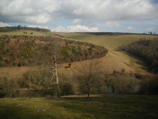
- View northwards over Swanbourne Lake
We ended up quite a large group - me, Ian, Graham, Keith, Eve (plus whippet), Alan and Michael. We agreed to meet at Arundel Station. I was coming from Croydon, the others from Brighton. Approaching Arundel I got a message to say the others had decided not to wait for their connection at Ford, but had set of to walk to Arundel along the River Arun. I therefore set off towards Ford, and met them on the riverbank, just outside the town.

- View from edge of Arundel Park, over Amberley
The walk took us through Arundel (stopping to buy water, socks and other miscellaneous provisions) and then up to the entrance to Arundel Park. Here there was a notice saying 'no dogs' - but I pointed out it couldn't apply the public right-of-way through the park, so we continued, accompanied by the whippet (a very polite and well behaved animal).

- Sheep in field, approaching South Stoke
We followed the route of the Monarch's Way through the park, passing Hiorne Tower, a folly built for the Duke of Norfolk in the late 18th century, and Swanbourne Lake. At the north end of the park there are superb views over the Arun valley and the South Downs. The path then drops steeply to the River Arun. Just before reaching the river we turned east, following the path to South Stoke.
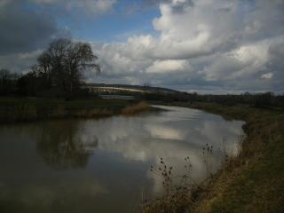
- River Arun, looking towards South Stoke bridge
Just before South Stoke the path followed the edge of a field full of sheep, with an electric fence between the sheep and the path. Unfortunately, one ewe had managed to get onto the path, and ran ahead of us. When she found she was trapped between us and a gate, she decided to jump the electric fence, which she cleared with surprising ease and grace.

- View over the Arun to South Stoke church
At South Stoke we paused on the bridge over the river to have a drink and a snack (Eve had supplies of cheese and black pudding). We then followed the river south then east to cross the railway at an occupation level crossing. The path into Burpham follows the original course of the river, now sluggish. Most of the water follows the cut made to eliminate the meander, which stays to the west of the railway.

- The whippet
The George and Dragon in Burpham describes itself as a 'public house and restaurant', and it is rather gastro. However, it accepted dogs and had good beer (Pickled Mouse from Arundel Brewery) and nice food, though being rather muddy and scruffy we felt more comfortable (if cold) sitting at tables outside.

- Mervyn Peake's grave, Burpham churchyard
After lunch the party split, some heading south to Arundel, and some of us continuing north to Amberley. Before setting off again, I persuaded the northbound party to look for Mervyn Peake's grave in the churchyard (Peake wrote the Gormenghast trilogy).

- Path north of Peppering High Barn
From the churchyard we took the lane to Peppering Farm and then Peppering High Barn. From Peppering High Barn we followed the footpath northwards, rather than the parallel bridleway. The footpath has better views, running along the top of the ridge. Our route then dropped down into a valley called the Burgh and then climbed again to join the South Downs Way near Downs Farm. The paths around Downs Farm are always foul and churned up by tractors, and today was no exception.
I had considered a detour into Amberley Village, but it was getting late so we decided to head straight for the Bridge Inn, following the South Downs Way to the B 2139 and then the path along road as far as the station.
In the Bridge Inn we were surprised to find the southern party, who had decided to take the train back from Arundel to meet us in the pub. So we had two or three pints in the Bridge Inn (Old Ale in my case) and then left to get our trains home.
A very enjoyable walk with good company, good weather and good beer.

- View over Amberley Wild Brooks from South Downs Way
24 April 2010: A walk from Falmer to Lewes by way of East Chiltington, to have a pint in the Jolly Sportsman
19.9 km (12.4 miles)

- Stanmer House, built 1722-27
After our walk on 20 February 2010 from Arundel to Amberley Station, Eve suggested that the Jolly Sportsman in East Chiltington was a good place for a pub lunch and so I agreed to look for a suitable walk passing through East Chiltington. At first I thought of a walk from Hassocks, but then decided it wouldn't be quite long enough. I therefore picked a route from Falmer over Stanmer Down and through Plumpton Agricultural College, returning from East Chiltington to Lewes by way of Black Cap - a satisfying double crossing of the South Downs.

- Bridleway, Stanmer Down
A number of people who hadn't come on our earlier pub walks had expressed interest, so I widened the circulation list. As a result, nine of us met on the train from Brighton to Falmer - myself, Ian, Graham, Keith, Eve (with the whippet), Haydn, Pat, Viv and Phil. It was a beautifully warm (almost hot) sunny morning, and it remained warm and sunny all day.

- Bullocks, Streathill Farm
From Falmer Station we walked through Stanmer Park to Stanmer village - a classic estate village. The park includes Stanmer House, built 1722-27 by the 1st Earl of Chichester, Thomas Pelham and Stanmer Church, rebuilt in 1838 on the site of a 14th century building.
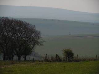
- View back from Streathill Farm
From the end of the street through Stanmer village we continued along the bridleway heading north and east over Stanmer Down to Streathill Farm. This is a beautiful part of the Downs, with lovely views back, and there were very few other walkers, despite the weather. At Streathill Farm the way was blocked by a group of bullocks, but they were old enough to be not very interested in us. Approaching the farm was a friendly notice saying 'Warning - Firearms in constant use on this farm - for your own safety stay on public footpaths - Mary's Farm' (St Mary's Farm is the one to the south of Streathill Farm).

- View from start of track to Plumpton
Just north of Streathill Farm we joined the South Downs Way for a short distance, before dropping down the track to Plumpton. I had planned to take the bridleway off to the left halfway down the scarp slope, to avoid passing the Half Moon at Plumpton and possible demands for an interim pint, but the party had got ahead of me and we missed the turning. However, we had made good time and so we passed the pub without stopping, taking the footpath from the pub to Plumpton Agricultural College across a field.

- Garden, Plumpton Place
The footpath passes Plumpton Place, which Pevsner describes as 'an enchanting place ... the house is of the C16 and C17, but now essentially the work of Lutyens, done in 1927-8 for Edward Hudson, the owner of Country Life'. Wikipedia adds that the gardens are by Jekyll, and that Led Zeppelin's Jimmy Page was a former owner.

- Wood near Novington Manor
There was charity dog show going on at the College as we passed. We followed the footpath to East Chiltington by way of Novington Manor. This passed through a small wood carpeted with celandines, early bluebells, wood anemones and violets.
In East Chiltington we stopped to look into the church (which Pevsner describes as 'Norman nave, with one window and both doorways recognisable. C13 W tower, short, with pyramidal roof').
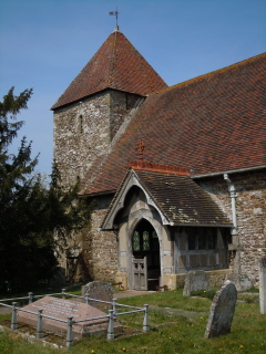
- Church, East Chiltington
The Jolly Sportsman was further along the lane. It looks as if the back of the pub faces onto the road. As Eve had said, it was an excellent place for lunch. Some went into the garden, and some stayed in the bar. I had a pint of Hophead by Dark Star, and butternut squash soup followed by a fillet of brill (Scophthalmus rhombus).

- The Jolly Sportsman, East Chiltington
After lunch Eve thought the whippet had probably had enough walking, so decided to get the train from Plumpton Station, only a kilometre away (but with an eccentric service pattern, making for a long wait). The rest of us decided to walk on to Lewes.
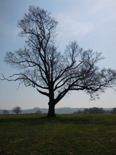
- Tree in fields near East Chiltington, South Downs behind
We took footpaths to just south of Wootton Farm, then turned south along the bridleway past Warningore Farm, crossed the B 2116 and started the climb up the scarp to Blackcap. A third the way up the scarp there is a choice of routes, arriving on the ridge either just to the west or just to the east of Blackcap. That to the west is longer, but looked less steep, and it had been my intention we would take this route. However, some decided on the shorter route (which turned out to be not that steep). We reassembled on the ridge, just below Blackcap. Whilst we waited for the western party, I diverted up to the summit to touch the trig point.

- Walking towards Blackcap
From Blackcap we followed the familiar route into Lewes passing the racing stables alongside the old racecourse and then Lewes Prison. Along the way we could see the distinct outline of a windmill that none of us could recall noticing before. It's a reconstruction of Ashcombe Windmill, a six sweep post mill destroyed during a gale in 1916.

- Trig point on Blackcap
There was a flurry of excitement when those at the head of the walk narrowly avoided stepping on an adder, coiled up on the path. Unfortunately I missed it, so no photograph.
Once in Lewes, Keith recommended the Lewes Arms, a Fullers pub, but also selling Harveys after a local campaign to get it reinstated. It's an excellent pub, which for some reason I've never visited before, and was as willing to sell tea as it was beer, so it suited everyone. On display was the Lewes Arms Pea Throwing Champion's trophy.
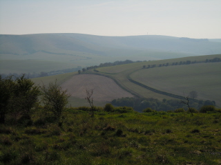
- Looking towards Newmarket Hill over old racecourse
From the pub it was a short stroll down the hill to get the train home.
The suggestion for the next pub walk is the Anchor Inn, on the River Ouse, with options for boating and a visit to the old Lewes to Uckfield railway for the enthusiasts (see log for Sussex Ouse Valley Way, 05 December 2009 - though Iím not proposing to repeat that walk).

- Lewes Arms Pea Throwing Champion's trophy
03 July 2010: A walk from Lewes to Uckfield by way of Barcombe, to have a pint in the Anchor Inn
17.3 km (10.8 miles)

- River Ouse, leaving Lewes, looking towards Offham Hill
After our walk from Falmer to Lewes on 24 April 2010, to have a pint in the Jolly Sportsman in East Chiltington, someone suggested the Anchor Inn at Barcombe for our next pub walk. I'd already walked from Lewes to the Anchor Inn as part of the Sussex Ouse Valley Way, so I thought Iíd look for an alternative route, but frankly I couldn't devise anything better, so decided on re-walking it. I'd last walked it in December, when it was very wet and muddy, so walking it in high summer would different.

- Hamsey church, from across the cut
From the Anchor Inn I planned a miniature 'Uck Valley Walk' to take us into Uckfield, for a pint in the Alma, a CAMRA-recommended Harveys pub.
For various reasons we were down on numbers for this walk - myself, Eve (with the whippet), Ian, Graham and Viv. We took the train to Lewes. From the station we followed my preferred indirect route to the banks of the Ouse at the Pells, passing Southover Grange Gardens (unfortunately barred to dogs, so we couldn't walk through the gardens, which are lovely), up Keere Street and Pipe Passage, down St John's Terrace and past Pells outdoors swimming pool (which Eve strongly recommended - it's fed by spring water).

- Sheep leaving pillbox, looking back to Offham Hill
From the Pells, the Sussex Ouse Valley way runs along the top of the flood defences until the cut at Hamsey, once the site of a lock. This section is usually very wet and muddy, but today it was baked hard. Along the cut at Hamsey, sheep were keeping cool in the shade of the bushes along the flood defence and were rather reluctant to shift out of our way. Some had decided try to try to keep cool in an old pillbox (one of a large number strung along the Ouse). They were disturbed by our passing, and we counted seven sheep trooping out from the pillbox.

- Malling Hill from near Cowlease Farm
From Hamsey the route leaves the banks of the Ouse to cross fields until it rejoins the river at Barcombe Mills. On the way we diverted to look at Barcombe Church - old in origin, but essentially Victorian following restoration. Inside was an interesting modern engraved glass screen separating the tower from the nave, in memory of Sir Alexander Grantham (presumably the Sir Alexander Grantham who was Governor of Hong Kong 1947-1957). In the field beyond the village the archaeological dig I'd passed in December has started up again. There was no one on site, but digging tools were scattered around. Perhaps the diggers had gone to lunch.

- View back to the Downs from Barcombe church
A little further on the route crossed the formation of the chord line connecting the old railway to East Grinstead (part of which forms the Bluebell railway) to the old railway between Lewes and Uckfield (part of which forms the Lavender Line).

- Cottage garden flowers, Barcombe
At Barcombe Mills the route threads its way past various ponds and weirs to rejoin the river. It was a hot day, and we passed a lot of people picnicking, swimming and messing about in boats - though it looks as if someone is going to attempt to fence off the river immediately north of Barcombe Mills - an attempt that deserves to fail.

- Archaeological dig, Barcombe
Just before the Anchor, near the site of Oil Mills lock, the path crosses the river to take the west bank. There was a herd of cows in the field right next to the bridge, accompanied by a muscular bull, who seemed quite unbothered by the steady trickle of people walking past him.

- Bull in field, near site of Oil Mills lock
The Anchor was, unsurprisingly, packed - a hot summer's day, the river, boats, a garden, real ale, and reasonable food. We found a picnic table in the garden with a sunshade, and had a very leisurely lunch (partly through choice, and partly because the kitchen was very busy so we had to wait our turn for food).

- Lavender Line, looking north
After lunch no one elected to take the short route back, taking the bus from Isfield, so we continued up the river for about one and a half kilometres, turning away from it just before the confluence with the River Uck. We followed a series of paths and tracks, skirting the edge of Isfield, to briefly join the Uck before crossing the Lavender Line - which is little more than a kilometre long from end-to-end.
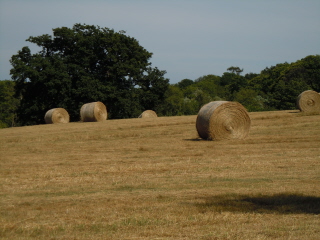
- Hay field, near Horsted Green
From the Lavender Line we followed a slightly zigzag route to Horsted Green, little more than a scattered hamlet. Along the way we used a stretch of lane marked on the map as an Ďother route with public accessí. This had a large depth gauge in the verge. The map shows this to be a ford, but there was no sign of water when we crossed it.

- Vintage taxi converted to fire engine, Horsted Green
In Horsted Green we passed a gentleman painting the windows of a workshop, and (perhaps looking for an excuse to stop painting) he invited us in to admire his collection of vintage cars, which included a Bullnose Morris. He was a retired undertaker, and he had built a cupboard out of an elaborate American steel coffin, which he used as a paint store.
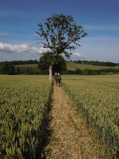
- Approaching the A 22
From Horsted Green Iíd picked a path that dropped down into a valley and crossed the A 22. After weíd crossed the road, the path up the other side of the valley took a little finding, as itís clearly not used much. Once we had found it, the cows in field decided to come up and inspect us for some reason. From there we went through a small patch of woodland (Boothland Wood) to reach the outskirts of Uckfield and then followed suburban streets to find the Alma - which fortunately turned out to be a very nice pub, and welcomed dogs. I had the Harveys Mild - at only 3%, itís ideal after a very hot walk.
We then retraced our steps to find the stop for the No 29 bus to Lewes, and so home.
A good walk on a very hot day. We agreed to think about another pub walk in August, while the weather was still hot - perhaps something from Berwick Station.
14 August 2010: A circular walk from Balcombe, to have a pint in the Oak at Ardingly
17.6 km (11.0 miles)
- Mobile phone mast, approaching Westup Farm
After our last pub walk we agreed to think about another pub walk in August, while the weather was still hot. Ian eventually suggested trying the Oak Inn at Ardingly. That naturally suggested a walk from Balcombe station, taking in Balcombe viaduct and Ardingly Reservoir and returning via the Loder Valley Nature Reserve. Unfortunately we were not going to get the brilliant sunshine and hot weather we had hoped for. The forecast was for cloud and heavy showers.

- View south over the weald, near White House
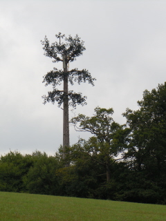
Eight of us met up on Balcombe station - me, Ian, Graham, Eve (with the whippet), Haydn, Pat, Viv and Toni, a friend of Viv's who was down on a visit. Despite the forecast, we set off in the dry, though there was no sun. The route I'd picked headed west for a short way to Westup Farm before turning south. Before reaching the farm there are a couple of absurd mobile phone masts in the form of unnatural pine trees, some branches pointing upwards and some pointing downwards ('Orange trees').

- Headless gnome, near crossing of River Ouse
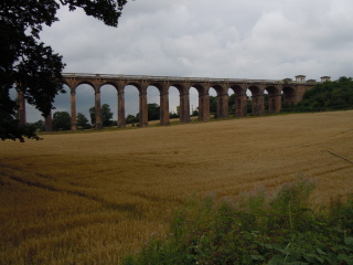
Navigating this first part of the walk was awkward as the route zigzagged down the join between OS 1:25 000 maps 134 and 135, crossing their centre folds. However, having narrowly avoided taking the wrong turn at White House I managed to get us onto the B 2036 to pick up the Sussex Ouse Valley Way, which we were to follow until it joined the High Weald Landscape Trail just to the south of Ardingly Reservoir. The route passed underneath Balcombe viaduct, which is truly spectacular. We stopped for the usual photo-opportunity, looking the length of the viaduct through the holes in the brick piers.

- Footbridge over the River Ouse, approaching Ryelands Farm
From the junction with High Weald Landscape Trail we walked north to reach the dam of Ardingly Reservoir. This short stretch of the walk partly follows the course of an old Roman road, though there is nothing on the ground to suggest this. The reservoir was significantly low, though not as low as I have seen it.
From the reservoir we walked up the hill to Ardingly church, the field path turning into a track and then a surfaced lane. We then walked eastwards along the road to reach the Oak Inn.

- Cattle, Ryelands Farm
We decided that it was warm enough to eat in the garden (we had the whippet with us) though it kept threatening to rain. There was a reasonable menu. I had very good sausage and onion baguette and a couple of points of Harveys.
After a leisurely lunch we set off again, no one electing to take the bus that stopped nearby.
- Balcombe Viaduct
We walked back to the church, but before we got there it started to rain, so we sheltered in the church porch to put on waterproofs. Our timing was fortunate, as it really started to bucket down. The church was locked, so we couldn't look round it. Pevsner notes it has some brasses that are 'above the ordinary in quality and condition'.

- Memorial to Christopher Toomer, died December 2001, aged 29
Once the rain had eased off a bit we ventured out to take the path northwards through the South of England Agricultural Society's show ground, and then turned west to drop down to a branch of Ardingly Reservoir that forms part of the Loder Valley Nature Reserve. Visitors to the nature reserve itself are limited to 50 a day, with tickets available from the visitor centre at Wakehurst Place, the country branch of Kew Gardens (well worth a visit).

- Ardingly Reservoir
The path crosses the reservoir by way of a high bridge (made of laminated wood beams on concrete piers).
I'd stopped to take some photographs and the others had gone ahead. Unfortunately they had taken the obvious, attractive, path from the end of the bridge that runs parallel to the reservoir, rather that the steep muddy path up through the woods that we should have taken. I therefore had to run ahead for some distance to redirect people up the correct path. However, at least the weather had started to improve.

- The Oak at Ardingly
Once we had climbed through the woods, we followed the lane northwards before turning south west for the final section into Balcombe. Where we turned off the lane there is a large house called the Crest, with its own miniature dual gauge railway running around the garden, much admired by the enthusiasts in our party.

- Footbridge over Ardingly Reservoir, Loder Valley
Our route then took us across the dam of Balcombe Lake, just above the western arm of Ardingly Reservoir; across the corner of the village cricket pitch (with a game in progress); and then into Balcombe itself.

- Balcombe Lake
We were not going to have time to catch next the train from Balcombe station (it only has an hourly service), so we decided to try the Half Moon Inn. I was thirsty, so limited myself to shandy. The pub itself was a bit disappointing and rather basic - I'd have expected something better, given that Balcombe is a rich little village. However, we were in good humour, having finished the walk and the weather improving, so we had an enjoyable time there. Toni demanded a certificate for having completed the walk - she is not a regular walker, but had completed it without complaint, despite the weather.
We then walked down to the station for the train home. A very attractive walk, even if I say so myself, with much of interest along the way. It would have been even better in sunshine.

- Balcombe village cricket pitch
23 October 2010: A walk from Bishopstone Station to Berwick Station by way of Alciston, to have a pint in the Rose Cottage
14.8 km (9.2 miles)

- Church of St Andrew, Bishopstone
After our last two pub walks, I thought a return to the South Downs would be good. I had in mind a walk somewhere near Firle Beacon - there are a number of good pubs in the villages under the scarp of the downs. Alan suggested the Rose Cottage Inn at Alciston, starting the walk at Bishopstone. As I like both Alciston and the Rose Cottage (which serves Harveys), I adopted the suggestion.

- Devilsrest Bottom, looking west
Ian, Eve (with the whippet), Graham, Alan, Phil, Haydn, Pat, Viv and I met up at Bishopstone Station, on the outskirts of Seaford. Bishopstone village itself is about a kilometre inland from the station. The station was built in 1936, with 'two pillboxes added at upper level in 1940'. Perhaps oddly, these face inland, and not out to sea.
The weather forecast had been dire, but the morning turned out to be bright and sunny, though windy - we could see the sea breaking spectacularly over the lights at the end Newhaven harbour.
- View towards Seven Sisters from Norton Top
We took the footpath to Bishopstone village, and called into the church, which was open in preparation for a wedding. The church is very old, some parts being Saxon in origin, and carefully restored. The prospective wedding prompted Eve to describe the Scottish tradition of Ďthe wedding scrambleí - throwing coins to children gathered outside the church - which Iíd not heard of before.

- The Beachy Head Marathon
The last time Iíd walked through Bishopstone there had been a fête on at the village hall behind the church, and I vaguely remembered walking through a garden to reach the path to Bishopstone Manor Farm that avoids the road, so I lead the party on this route. However, looking at the map again, we might have been trespassing - the actual right of way runs north-west from the church.

- View from Bostal Hill, looking east
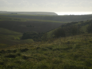
From Bishopstone Manor Farm we followed the lane to Norton, and then turned up the track along Devilsrest Bottom. At the same time as we were walking this section, a convoy of four-wheel drive vehicles appeared, taking pheasant shooters to the head of the valley. The convoy disturbed a few grazing cows, one of which followed us, bellowing occasionally. Leaving the shooters, we took the path up to the ridge leading to Norton Top (labelled Denton Hill on the OS 1:50 000 map). The downs here are very open, with fine views.

- Fields from path approaching Alciston
When we reached the top, we were faced with a seemingly endless stream of runners - we had picked the day of the annual Beachy Head Marathon. The Beachy Head Marathon (formerly known as the Seven Sisters Marathon) is one the biggest off-road marathons in the UK, and caters for walkers as well as runners.
To my regret, the trig point on Norton Top was not easily accessible, being fenced off with sheep netting and a double strand of barbed wire.

- Triangular bench, end of the lane into Alciston
We stopped for water and a snack when we got to the car park on the ridge between Firle Beacon and Bostal Hill, above Bopeep chalk pit. This was also a refreshment point for the marathon, with a liberal scattering of windblown polystyrene cups. From the car park we walked over Bostal Hill, and then turned north to take the footpath diagonally down the scarp and so into Alciston. From the top of the scarp there is an enormous view over the weald, and the weather made everything clear and sharp.

- Dovecot, Alciston
At the bottom of the scarp, the path splits. The most obvious route follows the contour westwards, but the route into Alciston crosses a stile. Unfortunately a couple of people missed the turning, and I had to go back to find them. Thanks to mobile phones, it didnít take long to get everyone back on track.
At the end of the lane into Alciston there is a fine triangular bench, one of the better legacies of the Millennium. Alciston is frankly charming - medieval barn and dovecot, old fashioned farm yard, picturesque cottages and church. And the Rose Cottage Inn, which was as I remembered it from my last visit.

- Rainbow, approaching Berwick
The beer was good and the food excellent (I had the casseroled Firle partridge). Alan had rung ahead to book a table, so we were comfortably seated next to the fire.
After a leisurely lunch we set off to walk to Berwick Station via Berwick village (the two are a couple of kilometres apart). Not long after leaving the pub, we were hit by a short but intense squall, and got a little wet. However, it cleared in minutes, leaving blue skies behind and a rainbow ahead.

- Christ in Glory, Duncan Grant, Berwick church
In Berwick most of us went to look at the church, famous for its wall paintings by Bloomsbury group painters. They are worth seeing. However, Alan went to look at the Cricketers Arms Inn, and when we went to find him it was perhaps inevitable we would stop for a drink, particularly as they were serving Harveys Old Ale, a personal favourite. The beer was good, but I think I preferred the Rose Cottage - itís a cosier pub.
From Berwick we followed the Vanguard Way to Berwick Station. It crosses a couple of fields that are always very sticky. Fortunately, they werenít newly ploughed, so we didnít get too clagged up. We reached the station to miss the train by about ten minutes, so we went to the Berwick Inn to wait for the next one (there is only one an hour). The Berwick is basic, but serviceable, and serves Harveys. Iíve used it as a station waiting room many times.
A good walk, in unexpectedly good weather, with some interesting things to see along the way. We agreed to a last 2010 walk in early December - perhaps in the Arun Valley.

- Near Stonery Farm, approaching Berwick

04 December 2010: A circular walk from Lewes, over Mount Caburn, to have a pint in the Snowdrop Inn
8.8 km (5.5 miles)

- Walking up Chapel Hill
I had planned to go to the reopened Abergavenny Arms for the last pub walk of the year, starting from Newhaven and finishing at Southease - a nice short winter walk. However, the country had come to a virtual standstill in the couple of days before the date of the walk, with deep snow and extreme sub-zero temperatures. The best available information indicated that there would be no Brighton to Newhaven train service, but there would be a limited Brighton to Lewes service.
After a blizzard of e-mails, we agreed on Plan B: meet at Brighton at 10:00 and then aim to do a circular walk from Lewes, with, at Eveís suggestion, lunch in the Snowdrop Inn.

- Mount Caburn from Lewes golf course
There had been a thaw overnight, and Brighton and the surrounding downs were unexpectedly snow free. There even seemed to be trains to Newhaven, though they didnít seem to be stopping at Southease. Nonetheless, we decided to continue with Plan B, so I, Viv, Haydn, Pat, Eve (with the whippet), Ian, Keith and Alan got the train to Lewes. All of us were over-dressed, expecting bitterly cold weather. It was actually rather mild.

- Walking over Saxon Down
In Lewes we walked to the High Street, where there was a farmersí market in progress, with some nice looking food on sale. From the High Street, we continued to Cliffe and walked half way up Chapel Hill, to take the footpath over the golf course on Cliffe Hill. There were no golfers about, but a lot of stray golf balls, perhaps lost in the snow. No one took up my offer of a bit of light trespassing to visit the trig point, so we carried on to Saxon Down. Here we were entertained by a not very convincing display of sheepdog handling. If the idea was to shepherd the sheep in any particular direction, it seemed to be failing.

- View across Glynde to Firle Beacon
From Saxon Down we headed to Mount Caburn itself. By now the weather had become threatening, with a spectacular localised downpour in the direction of Berwick. It also looked very black ahead of us, and now and then someone would stop to put on a waterproof garment. The rain finally hit us as we arrived at Mount Caburn. It was an intense downpour, but didnít last long.

- Rain coming in, approaching Mount Caburn (looking west)
Mount Caburn has a wonderful view over the Ouse valley, the river showing silver against grey. It was too wet for photographs, and too wet to linger long, so we headed back to Lewes, dropping directly down Caburn Bottom (which is open access land), rather than retracing our footsteps to pick up the usual path.

- Rain clearing, Caburn Bottom
Where Caburn Bottom meets Oxteddle Bottom is an old, concrete-lined dew pond. Someone has now found it necessary to fence it off - another small erosion of the countryside.
From the dewpond, we walked up to the clubhouse of Lewes Golf Club. From the cliffs next to the clubhouse we paused to take in the views over Lewes. Usually there are aerobatic displays here by the local rooks and jackdaws, but they were not performing - I think because we were just too early.

- Dew pond, Oxteddle Bottom
We then walked back down Chapel Hill and along South Street to have lunch in the Snowdrop Inn ('The home of the South Street Bonfire Society'). The pub sits underneath the cliff, and is named after the avalanche that happened in 1836, killing 8 people - according to Wikipedia It remains the deadliest avalanche on record in the United Kingdom. .

- View over the Ouse from cliff near golf clubhouse
The Snowdrop turned out to be a really excellent choice - friendly, very good food at a reasonable price and Harveys Old Ale. As we had nowhere further than the station to walk to after lunch, we stayed there most of the afternoon. A very convivial end to this yearís pub walks.
We agreed that the first walk next year should be another attempt on the Abergavenny Arms, in early February - weather permitting of course.

- The Snowdrop Inn


