| Date | Walk | Distance |
|---|---|---|
| 17 January 2010 | South Nutfield - Whyteleafe | 17.0 km (10.6 miles) |
| 06 February 2010 | Whyteleafe - Tatsfield - Hawley's Corner | 20.1 km (12.6 miles) |
| 13 February 2010 | Hawley's Corner - Cernes Farm - Edenbridge | 20.5 km (12.8 miles) |
| 14 February 2010 | Edenbridge - Cernes Farm - Dormans Station | 15.7 km (9.8 miles) |
| 07 February 2010 | Dormans Station - Burstow - Horley | 17.7 km (11.1 miles) |
| 23 January 2010 | Horley - Smallfield - South Nutfield | 11.8 km (7.4 miles) |
I've now completed the Tandridge Border Path, spread over 6 days of walking. If you want to walk the borders of Tandridge, then this well-designed path is the way to do it. However, I'd give this path a low priority if you have not yet walked many of the other long distance paths south of London. The best sections are those that follow the boundary with Kent - but the Vanguard Way offers an excellent alternative. I walked the path in winter - I think it would be better in high summer.
I used the first edition of the guide-book, published by Per-Rambulations. It proved to be both accurate and useful. The introduction says '... public transport is limited' - which fortunately isn't the case, though I needed to add two or three km to get to and from some railway stations and bus stops.
The official route length is 50 miles. By my measurement, it is actually nearer to 55 miles long. The distances in the table above add up to 64.3 miles, as I've included the connecting walks need to reach railway stations and bus stops from the beginning and end of each day's walk.

- Tandridge Border Path waymark
17 January 2010: South Nutfield - Whyteleafe
17.0 km (10.6 miles)

- Urban pony, Nutfield Marsh
Although I've got several projects on the go, I wanted to start another regular long distance path. The forecast for Saturday was for steady heavy rain, but for Sunday it was sunny intervals, so I chose to walk on Sunday. This limits transport options, but the Tandridge Border Path is well served by trains, close to London, and I haven�t walked it, so I decided it was a good choice. I haven�t been walking in the North Downs for some time, so it also offered a change of scenery (though I prefer the South Downs).

- Spynes Mere Nature Reserve
The Tandridge Boarder Path is circular, so though it officially starts and finishes in Tatsfield, it didn�t matter where I started from. I therefore picked an easy option and started from Nutfield Station (actually in South Nutfield), which required a change of trains at Redhill, with a six minute connection.

- Survey point, M 25 / M 23 junction
The path starts by heading north along the road through South Nutfield (a dormitory village of largish, mainly Edwardian, houses), crossing the Greensand Way. There is a brief stretch along the A 25, and then the path continues northwards along footpaths, initially across a stretch of neglected countryside. It crosses Nutfield Marsh, a scrubby bit of common land with a couple of tethered urban ponies, and then passes Mercers Farm, the old farm buildings converted into a small village. As it approaches the M 25 / M 23 junction, the path passes a number of old sand pits, one of which has become Spynes Mere Nature Reserve, leased by Surrey Wildlife Trust from WBB Minerals in 2003.

- Looking back from top of North Downs, towards Reigate Hill
Crossing the M 25 requires a long detour into Merstham, following a path along the top of a bund alongside the motorway, to use a footbridge. The path then climbs steeply up along a path between suburban fences to join the North Downs Way. The Tandridge Border Path stays with the North Downs Way for the climb to the top of the North Downs, passing under the M 23 and the slanting up the scarp of the Downs on a very muddy footpath across recently planted fields.

- Fields near Court Farm, Chaldon
At the top of the Downs (from where there are very fine views south), the Tandridge Border Path leaves the North Downs Way and joins the waymarked Downlands Circular Walk. This follows a farm track, crosses fields, goes through a wood (where Lords and Ladies were beginning to poke up through the leaf litter) and then crosses more fields to reach Chaldon Church.

- Chaldon Church
The Tandridge Border Path guide book (first edition) noted that the church contains a fine wall painting from around 1200 (restored). The service was still going on as I arrived at about midday, so I stopped to have my sandwiches and waited for the congregation to emerge. I asked someone if the church would remain open after the service, and was told it would, and I might get a cup of coffee. Everyone was very welcoming, and I got to see the wall painting. It depicts the ladder of salvation, with a heavy emphasis on damnation.

- Wall painting, Chaldon Church (detail)
At Chaldon, the Tandridge Border Path leaves the Downlands Circular Walk, only to rejoin it very soon to cross the head of Happy Valley, where the two paths finally separate. The Tandridge Border Path heads up Dean Hill and then skirts a large new development on the edges of Caterham (which was rather more interesting than the usual bland housing estate). The path follows the edge of Coulsdon Common (City of London owned, with an example of a coal post), passes through Old Coulsdon (the not-very-old bit) and then joins the London Loop (which I have walked).

- Coal post, Coulsdon Common
The path follows the edge of Kenley Airfield (created in the first war, and important in the second), to enter Kenley Common (again, City of London owned). On the far side of the airfield (now used by gliders) the path drops down to the suburban streets of Whyteleafe (I think it's Whyteleafe, but the names of the suburbs here are confusing). Just before reaching the street, the path passed through a field with a dense cluster of mounds looking like miniature tumuli - termite mounds I'd guess.

- Small observatory, edge of Kenley Airfield
There are two railways through the valley, offering a choice of trains from either Whyteleafe Station or Upper Warlingham station. I chose the latter, crossing over the first line by footbridge and under the second line through a brick arch bridge leading to a recreation ground.
At Upper Warlingham station I found I had 35 minutes to wait for a train, so I wandered down to the A 22 and picked up a passing No 407 bus to Croydon. It was more interesting than waiting for the train.
The weather was beautiful - warm and sunny all day, though it was wet underfoot from yesterday's rain, with occasional lingering patches of snow.

- View over Whyteleafe
23 January 2010: Horley - Smallfield - South Nutfield
11.8 km (7.4 miles)

- Ditch, outskirts of Smallfield
I only had time for a short walk today, as I had to be back early to get ready to go to listen to the Sussex Choral Society singing the Messiah in Brighton. This fitted in well with my plan for walking the Tandridge Border Path, which included a short section from between Smallfield and South Nutfield, accessed from Horley station (the plan being determined by the availability of convenient public transport).
I took the train to Horley. From the station I headed east along the road to reach the B 2036, from where there is a typical urban path between fences leading to the edge of Horley. The path was very muddy, and in places under a couple of inches of water - typical of conditions underfoot for the rest of the walk.

- View southwards, from below Outwood
From the end of the path I took the bridleway to Thunderfield Castle (site of). There is nothing of the castle to be seen, other than what looks like the remains of a moat. The site is now little more than a junkyard, full of sheds and abandoned vans.
From Thunderfield Castle (site of) I continued along the bridleway, now a lane adjoined by bungalows with stables, big gates and large ugly dogs. A short left and right then took me to the bridge under the M23, the other side of which I picked up the route of the Tandridge Border Path.

- Porch, Outwood Church
From the M23, the path heads due north, parallel to the motorway, on roads, bridleways and footpaths, to reach Outwood, passing through Smallwood and around Burstow Lodge Farm.
Perhaps the gloomy and overcast weather made me see the worst, but the country between Horley and Outwood looked ugly and uncared for, a land of litter, uncompleted building projects, overgrazed pony fields, barking guard dogs, mildewed horse trailers and abandoned vans, fit only for horse riders. Fortunately things improved a little after Outwood.
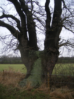
- Pollarded oak, north of Burstow Park Farm
Outwood has a pub, the Castle, but it was too early for a beer. Just north of Outwood the path reaches Outwood Common, owned by the National Trust. Here I made a short diversion to look at the church. A typewritten notice in the porch told me that the church was 'built to the design of a notable Victorian Architect, William Burges. The church was consecrated by Samuel Wilberforce, Bishop of Winchester'. It added that 'The saddleback tower was added in 1874 and contains 4 bells'.
Unfortunately, the church was locked, so I couldn't see inside. Burges was a remarkable architect, working in the gothic revival style, most famous for Castell Coch and Cardiff Castle, both designed for the Marquess of Bute. The church, if it is by Burges, is remarkably restrained. It is built of a very poor quality Reigate stone that is now crumbling badly. Reigate stone is, according to one of English Heritage's National Monuments Record Thesauri, a 'Soft, medium grained, green/grey coloured, highly calcareous, cretaceous sandstone. Mined (more frequently than quarried) since pre-Norman times from the Reigate area of Surrey'.

- M 23, south of Soth Nutfield
In Outwood Common I found a number of interesting fungi growing on dead wood. The honeysuckle was showing its new leaves, hinting at spring.
North of the common, the path crosses fields, passing Burstow Park Farm, a handsome Georgian farmhouse with large barns. Here I passed a small shooting party, out for pheasants.
At Henhaw Farm, the path turns west to cross the motorway. The farm had a maltings, built in 1895, now converted to flats. Across the road from the farm is a more than usually ugly stables and pony paddock.

- View eastwards from outskirts of South Nutfield
The path crosses the M 23 on an overbridge, then turns north, passing a nursing home (from which came a strong smell of scent). The path then goes through a patch of Woodland Trust land and crosses the railway by way of a footpath level crossing. After a short distance across a couple of small fields, the path briefly joins the Greensand Way along an unmade road to reach South Nutfield. Here I turned south to get the train back home from Nutfield station.
A gloomy day, soggy conditions underfoot and often unattractive scenery made this one of those walks you do because it's necessary to complete a long distance path, rather than because it's enjoyable.
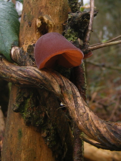

- Fungi
06 February 2010: Whyteleafe - Tatsfield - Hawley's Corner
20.1 km (12.6 miles)

- View back under railway bridge to Whyteleafe
I took the train to Upper Warlingham station to pick up the Tandridge Border Path where I had left it on 17 January.

- Goat damaged tree above chalk pit
The path crosses the 'Riddlesdown to Whyteleafe Countryside Area', following the railway northwards. Different bits of the area are owned by Tandridge District Council, London Borough of Croydon and the Corporation of London. The path turns eastwards where it meets a large chalk pit. I noticed that the smaller trees around the lip of the pit had been very neatly stripped of their bark. I then spotted the cause - a flock of large black and white goats.

- Trees in the mist, near Hamsey Green
Just beyond the chalk pit the path joins the London Loop, and stays with it through Hamsey Green and Selsdon Wood, where the two paths separate. In Selsdon Wood I passed a fallen tree that someone had carved into a dragon which a few deft cuts of a chainsaw. The path then skirts Frith Wood and turns north to reach Featherbed Lane, just south of New Addington. This is a land of golf courses. The path follows the lane some way, and then turns south at Frylands Wood Scout Camp.

- Dragon in Selsdon Wood
Just beyond Little Farleigh Green Farm is a coal post at a gate across the footpath. It's slightly incongruous to see what is essentially a piece of street furniture in the middle of nowhere.

- Coal post near Little Farleigh Green Farm
The path then goes on to Fickleshole, a hamlet with a large rambling pub called the White Bear. They were advertising a beer festival, so though it was only a little after half-past eleven, I decided to call in for a pint - Grasshopper Kentish Bitter from Westerham Brewery, a nice beer.
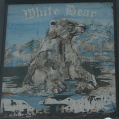
- White Bear
The path then follows a lane to cross the Greenwich Meridian, which it then crosses twice more within the next couple of kilometres.
The path passes the church of St Leonard, Chelsham, sitting by itself in the fields. The structure looks Victorian (the result of a restoration in 1871), though the church is older. I stopped to eat my sandwiches on a bench next to the porch. Unfortunately, the church was locked. There was a beautiful group of snowdrops growing on one old grave, but nowhere else. The first snowdrops I've seen this year. I assume they are a cultivar, rather than wild.
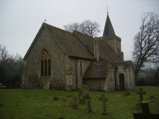
- Church of St Leonard, Chelsham
Further south, at Chelsham Court Farm (rather tumbledown) is a large radio mast, with a interesting (if you are an engineer) tripod base. A little further on the path passes a trig point at 222 m, still in use as part of the OS National GPS Network. From here the path drops into a valley, the prettiest bit of landscape on today's walk. The path then climbs to Beddlestead Farm and goes on to the village of Tatsfield, the official start and finish of the Tandridge Border Path. The village has a village pond, which hasn't been tidied up, plus a large pub, the Old Ship.

- Flint in field approaching Chelsham Court Farm
From here the path heads south to join the North Downs Way, just beyond St Mary's church, perched on the lip of the downs, with fine views south over the weald. The church was open, but not particularly interesting.

- Trig point, beyond Chelsham Court Farm (222 m)
The Tandridge Border Path and the North Downs Way are coincident for a short way, following Chestnut Avenue. I left the path just before they split, to take an unmade road to Hawley's Corner at the top of Westerham Hill, where I planned to get the bus.

- Valley between Chelsham Court Farm and Beddlestead Farm
The highest points in Kent and Greater London lie either side of the A 233 close by. I have been to visit both, but can't say I've actually stood on the spot. There is a 245 contour, and locating the exact top within this contour calls for nice judgement (and probably a little trespassing).
I had 20 minutes to wait for the bus, so I walked along the A 233 to the stop outside the Fox and Hounds in South Street. Then I took the No 246 to Coney Hall where I changed onto the No 119 to Croydon.
The weather was very grey and misty, the mist not clearing until the afternoon. As a walk, I'd say it was good in parts.

- Village pond, Tatsfield
07 February 2010: Dormans Station - Burstow - Horley
17.7 km (11.1 miles)

- Path repair, west of Dormans Station
The forecast was for overcast weather, but dry, so I decided to tackle another section of the Tandridge Border Path. As buses to Hawley�s Corner, where I had finished yesterday, are only hourly on Sunday, I decided to walk between Dormans Station and Horley station, relying on the train.

- Fields, north of Chartham Wood
At Dormans Station I got off to a bad start. I misread the Tandridge Border Path waymark by the side of the road opposite the station and, not having read the instructions in the guide book, I set off on a pleasant path southwards alongside the railway. However, I soon realised that the path wasn�t behaving as the sketch map in the guide book suggested it should, so I retraced my steps to find the right path heading south.

- Old sweet chestnut, Felbridge
This path passed a number of very large houses - clearly this is a wealthy area. At one point an unusual method has been adopted for repairing the path surface through a boggy section - fence posts stapled together to form a ridged wooden surface. It's not very comfortable to walk on.
The path meanders south-westwards to Felbridge on the A 264. On the way it crosses the course of Chartham Park Golf Club, with the usual tricky navigation across the fairways.

- Hedgecourt Lake
Through Felbridge the path follows a wide suburban street lined on one side by the remains of huge old sweet chestnuts. I�d guess that street had once been the driveway of an estate. Once out of Felbridge, the path heads north to skirt Hedgecourt Lake. This part of the walk was disturbed by the loud whine of off-road motorbikes somewhere to the north.

- Car storage, Effingham Road
On the north side of the lake there is a small sailing club, where a working party was raking up leaves.
From the lake the path continues generally westwards, across fairly dull countryside, occasionally enlivened by unexpected industrial sites, including an area of car storage.

- Narrow footbridge, New House Farm
Just north of Copthorne the path joins the Sussex Border Path to turn northwards. It was here, whilst walking the Sussex Border Path, that I first discovered the Tandridge Border Path by finding a waymark. The paths cross a large, soft field to New House Farm (their sign advertises �American Quarter Horses� - an American breed of horse that excels at sprinting short distances) and then continues north over fields and along a lane to Burstow. In the field to the north of New House Farm I found an unexpectedly rich collection of small flowering plants, not all of which I could identify, though they included Groundsel and Ground Ivy.

- Burstow church
Approaching Burstow there was a field full of scruffy, but not unattractive, piebald horses. Brustow itself has a church and a couple of very grand old houses, but no village. It�s also directly under the flight path for Gatwick Airport, which is only two kilometres due west.
The church has been subject to very heavy Victorian restoration, but is rather pretty, with a very peculiar wooden tower and spire. John Flamsteed (1646 - 1719), the first Astronomer Royal, was once the rector.
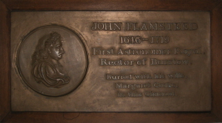
- Plaque commemorating John Flamsteed
From Burstow the path continues north, gradually approaching the M 23, to reach the point where I had joined the path on 23 January. From there I retraced my route to Horley Station for the train home. On the way I saw my first lamb of the year.

- Stables north of Burstow (neater than most)
13 February 2010: Hawley's Corner - Cernes Farm - Edenbridge
20.5 km (12.8 miles)

- Lane on North Downs, near Hawley's Corner
I took the No 119 bus to Coney Hall, and changed onto the No 246 to return to Hawley's Corner, just east of Tatsfield, to pick up the Tandridge Border path where I had left it on 06 February. It was a lovely clear day, with a thin scattering of snow on the top of the North Downs.
The path tracks down the scarp of the downs to Tatsfield Court Farm, then picks up Clacket Lane to cross the M 25 at Clacket Lane services.

- View back to North Downs, from near Clacket Lane
The path continues along Clacket Lane as far as the A 25, to near the extraordinary Grasshopper Inn. At first glance I took the inn to be a classic 1930's road house in mock Tudor style. The Grasshopper's website describes it as �a truly unique venue which is steeped in history and oozing with character. Bedecked with traditional features, natural wooden beams, quirky decor and terraced garden, this 12th century Inn is exceptionally versatile'. Which I think says it all. Unfortunately, it was far too early for a beer, so I didn't get the chance to see the quirky decor.

- The Grasshopper Inn from Moorhouse Bank
From the A25 the path continues south, crossing the High Chart, an area of woodland and random paths on the greensand ridge. Fortunately both the waymarking and the directions in the guidebook were very clear, and navigation, though intricate, wasn't a problem. The Tandridge Border Path crosses the Greensand Way here, at its halfway point. The halfway point is marked by a low plinth with a cast metal sign giving a distance of 55 miles westwards to Haslemere and 55 miles eastwards to Hamstreet.

- The High Chart
At Kent Hatch, the path heads westwards for about half a kilometre to briefly join the Vanguard Way. Until the Tandridge Border Path decisively heads westwards, beyond Dry Hill, the two paths follow a similar route southwards, occasionally being coincident.
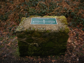
- Halfway point of the Greensand Way
The Tandridge Border Path and Vanguard Way split at Trevereux Manor, with the Tandridge Border Path taking a more westerly route. The path aims for Staffhurst Wood, for no better reason that I can see than there is a car park there. On the way it crosses the Uckfield Line by a footpath level crossing.

- Old barn on Guildables Lane
The path then takes a rather zigzag route south, crossing the East Grinstead line, to pick up the line of the Kent Brook, which (as its name suggests) marks the border between Kent and Surrey. The official right of way to the footbridge over the brook crosses a large field. However, this had just been sprayed with slurry and was in the course of being ploughed, so I followed round the headland. Not a big detour, and far less mucky than the official route.
I had originally planned to walk into Edenbridge along the road crossing the Kent Brook, to get the train home. However, as there was plenty of time, I decided to continue south as far as Cernes Farm and then walk to Edenbridge along the Eden Valley Walk. The Eden Valley Walk is a 24 km / 15 mile link walk between the Vanguard Way (at Cernes Farm) and the Wealdway (in Tonbridge). It looks like a good walk.

- Golf course near Kent Brook
Before reaching Cernes Farm, the Tandridge Border Path crosses the River Eden and the Eden Brook near their confluence. It also crosses an airstrip, with a sign warning 'Caution - Aeroplanes' (though there were none to be seen that day).

- Ploughing near Kent Brook
The Eden Valley Walk largely follows the river Eden into Edenbridge, passing the Devil's Den, the site of an old moat. I have a memory of walking it once before - I think as part of a long-lost route I devised to walk from London to Brighton only using trains as public transport.
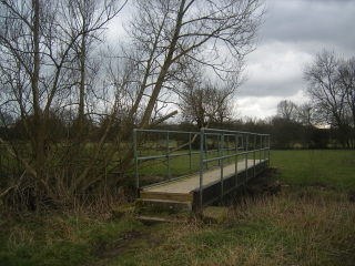
- Footbridge over the River Eden
Edenbridge itself looks rather run down compared to how I remembered it, with closed shops and pubs. The Old Crown Inn, the main pub in the town, looked closed, with a boarded up window in the entrance door. However, it proved to be open and under new management, so I stopped for a pint of Hobgoblin - strangely, it was the weakest beer they had.
I then took the train home from Edenbridge Town. The town had the luxury of two railway stations, Edenbridge Town on the Uckfield line (diesel) and Edenbridge on the East Grinstead line (third rail). The weather deteriorated from its early promise, but remained dry.

- Eden Valley Walk waymark
14 February 2010: Edenbridge - Cernes Farm - Dormans Station
15.7 km (9.8 miles)

- River Eden, just outside of Edenbridge
I decided that as I had only one shortish section of the Tandridge Border Path to complete, I'd also go walking on Sunday. I set out in drizzle, and took the train to Edenbridge Town. On the way I was surprised to see some significant snow covering the scarp of the North Downs. My train arrived half an hour late, as it was delayed by another train struggling to clear a section due to adverse weather conditions (according to our guard). At Edenbridge I decided not to put on waterproofs. This turned out to be the right decision, though the day remained gloomy, with occasional light drizzle.

- Derelict cottage, approaching Dry Hill
I retraced my steps along the Eden Valley Walk to Cernes Farm, to rejoin the route of the Tandridge Border Path and the Vanguard Way. This path is popular with dog-walkers.

- Tree stump on Dry Hill
Just south of Cernes Farm is Starborough Castle. Only the moat remains of the original castle, but in the eighteenth century a gothic style ornamental pavilion was built on the site re-using medieval material. The top of the pavilion can just be glimpsed from the path, behind a large eighteenth century house.

- Trig point on Dry Hill
The Tandridge Border Path follows the Vanguard Way over Dry Hill, with the exception of a short section starting at the end of the drive to Starborough Castle. The Tandridge Border Path goes via Hooper's Farm (fairly traditional looking, but with converted barns) - as far as I can see for no better reason than to be different.

- Sheep hoping for food
Dry Hill was rather wet. There is a reservoir on the top, and the remains of what looks like an Iron Age fort. There is also a trig point (172 m), though I resisted going to touch it (too wet, gate locked, possible bull in field, passing local on a horse ...).

- Old Surrey Hall
I've walked over Dry Hill several times before, both north-south and east-west, and circumnavigated its summit. I quite like this patch of border territory between Surrey and Kent with Sussex just a mile or so to the south, but couldn't say why.

- Cook's Pond Viaduct - south end
The two paths go their separate ways just before the Vanguard Way crosses the A 264. About here a flock of sheep came running up to the gate as I passed along the lane. I think they thought I might have food. After the paths separate, the Tandridge Border Path turns westwards, crossing some fields which give odd impression of remoteness. The path then takes the driveway to Old Surrey Hall, an impressive assemblage of timber-framed and stone buildings.

- Cook's Pond Viaduct - from north end
From Old Surrey Hall the Tandridge Border Path briefly follows the route of the Sussex Border Path, but the paths diverge on the outskirts of East Grinstead. The Tandridge Border Path then follows the road to Dormansland for a short way, before taking a path leading under Cook's Pond Viaduct. The viaduct carries the East Grinstead line over a lake - a very impressive lattice girder structure on brick piers. The path must cross the meridian hereabouts.
The path finishes by following the footpath alongside the railway to Dormans Station, from where I got the train home. I only had ten minutes to wait for a train - if the wait had been longer, I'd have been tempted to walk on to Lingfield, where the map showed there was a pub.

- Vanguard Way waymark


